


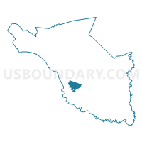
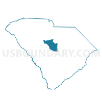
Bluff Voting District, Richland County, South Carolina
About
Outline

Summary
| Unique Area Identifier | 666559 |
| Name | Bluff Voting District |
| County | Richland County |
| State | South Carolina |
| Area (square miles) | 8.11 |
| Land Area (square miles) | 8.08 |
| Water Area (square miles) | 0.03 |
| % of Land Area | 99.62 |
| % of Water Area | 0.38 |
| Latitude of the Internal Point | 33.93483470 |
| Longtitude of the Internal Point | -80.96082180 |
Maps

Graphs
Select a template below for downloading or customizing gragh for Bluff Voting District, Richland County, South Carolina


Neighbors
Neighoring Voting District (by Name) Neighboring Voting District on the Map
- Brandon Voting District, Richland County, SC
- Hopkins Voting District, Richland County, SC
- Hunting Creek Voting District, Richland County, SC
- Meadowfield Voting District, Richland County, SC
- Mill Creek Voting District, Richland County, SC
- Olympia Voting District, Richland County, SC
- South Beltline Voting District, Richland County, SC
- Woodlands Voting District, Richland County, SC
Top 10 Neighboring County Subdivision (by Population) Neighboring County Subdivision on the Map
- Columbia CCD, Richland County, SC (168,103)
- Horrell Hill CCD, Richland County, SC (12,570)
- Hopkins CCD, Richland County, SC (6,424)
Top 10 Neighboring Place (by Population) Neighboring Place on the Map
Top 10 Neighboring Unified School District (by Population) Neighboring Unified School District on the Map
Top 10 Neighboring State Legislative District Lower Chamber (by Population) Neighboring State Legislative District Lower Chamber on the Map
- State House District 72, SC (40,039)
- State House District 80, SC (39,082)
- State House District 75, SC (37,149)
- State House District 70, SC (28,992)
Top 10 Neighboring State Legislative District Upper Chamber (by Population) Neighboring State Legislative District Upper Chamber on the Map
Top 10 Neighboring 111th Congressional District (by Population) Neighboring 111th Congressional District on the Map
Top 10 Neighboring Census Tract (by Population) Neighboring Census Tract on the Map
- Census Tract 119.01, Richland County, SC (7,590)
- Census Tract 118, Richland County, SC (6,424)
- Census Tract 116.04, Richland County, SC (5,946)
- Census Tract 117.01, Richland County, SC (5,137)
- Census Tract 116.07, Richland County, SC (3,800)
- Census Tract 117.02, Richland County, SC (3,550)
- Census Tract 26.04, Richland County, SC (1,697)